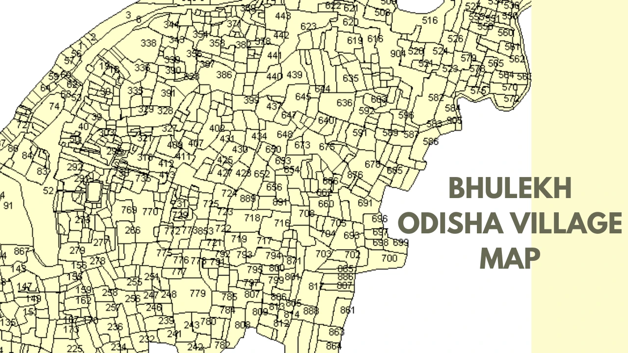
Bhulekh Odisha is an online platform developed by the Government of Odisha to digitize paper-based land records and make them available to citizens for easy access. Its most significant feature includes village maps from which the user can identify and understand geographical details of lands for location. A feature known as the Bhulekh Odisha Village Map provides a convenient means through which villagers and farmers can gain access to information regarding the parcels of land, ownership, and boundaries within a village.
In this article, you are going to learn everything that needs to be known about accessing and using the Bhulekh Odisha Village Map. Content includes navigating through the portal, the advantages of its use, and FAQs in understanding and making the best use of this service.
What is Bhulekh Odisha?
Bhulekh Odisha is the concept by which the government of Odisha has presented digital land records. It enables users to see, search, and freely download information on what the issue is about land with so much ease. The main motive of Bhulekh Odisha is that persons from the society should not have to go to governmental offices to get basic information related to the land matter.
Features:
- Land Record Details ROR – Record of Rights
- Village Maps
- Online Mutation
- Tahasil Information
- Khatiyan and Plot Information
What makes the Bhulekh Odisha Village Map Important?
Bhulekh Odisha Village Map is a very useful tool for people. It helps in the following tasks:
- Identifying boundaries
- Confirming ownership rights
- Getting accurate geography information
- Planning agriculture
- Resolving land disputes
How to Check the Bhulekh Odisha Village Map?
- Access the bhulekh.ori.nic.in website. A number of options with regard to the land records are available on the homepage.
- Map View Option: Find the tab ‘Map View.’ Clicking on that will open the village map section.
- Choose Your District: The list of districts in Odisha appears. Select a district by which your land lies.
- Select the Tehsil and Village: Once you select the district, you choose the relevant Tehsil administrative block. Choose your village from the dropdown list.
- View the Village Map: As soon as you choose your village, this map will get loaded. You can zoom in and zoom out from the map. Simply roam around the map to find plots
- Download or Print the Map: For easy record downloading or printing the village map if required. To print use the print option found on the map interface.
Advantages of Bhulekh Odisha Map
- Saves your valuable time and is convenient.
- No longer would you have to visit the government offices to look up your records on land.
- Detailed maps available from your home
- Land Transaction Transparency
- Tracks the relevant information concerning the lands accurately and in real-time, thus bringing in transparency.
- Risk of fraud and land disputes decreases.
- Easy Accessibility
- The portal is a user-friendly one and can be accessed at any time and anywhere 24/7.
- NRIs and people living abroad can also avail themselves of their land details.
- Facilitates Land Management and Planning
- Useful in planning agricultural activities to the farmer.
- It helps in identifying the type of soil, water sources, among others geographical features.
- Accurate Data
- Updates are done frequently; hence people will be able to receive timely information.
- Digital data lessens the chances of errors and data loss.
Features of Bhulekh Odisha Village Map
| Feature | Description |
| Boundaries of Land | Clearly marks the boundaries of each piece of land. |
| Owner Details | Information on ownership. |
| Plot Numbers | Each plot is provided with a unique number. |
| Soil and Water Sources | Specifications on types of soil and availability of water sources nearby. |
| Geographical Coordinates | Locations can be easily identified using coordinates. |
| Satellite View | Satellite images of the area are available. |
FREQUENTLY ASKED QUESTIONS
Q1. Is the Bhulekh Odisha Village Map accessible in all the districts?
Ans. Yes, the Bhulekh Odisha Village Map provides you with the details of all the districts in Odisha. You can access maps of any village by choosing the correct district and Tehsil.
Q2. Are we able to download the Village map through the portal?
Ans. Yes, you can easily download or print the village map by using the options available on the map interface.
Q3. How frequently is Bhulekh Odisha updated?
Ans. The revenue department gives Bhulekh Odisha new data regularly so that it is correct.
Q4. Are there Bhulekh Odisha apps for mobile?
Ans. As yet, Bhulekh Odisha has not released its own official app for mobile; however, there are third-party apps which might allow you access to some of its features.
Q5. What if I have an issue accessing the village map?
Ans. In case any problem arises, there exists a support team to help you out; the contact numbers of which are also displayed on the Bhulekh Odisha website.
Conclusion
The Bhulekh Odisha Village Map is a powerful tool. It brings transparency, ease, and accuracy to land management in Odisha. Digitizing land records makes it easier for citizens to have information on such essential details that are related to property. This portal minimizes the hassles of land detail management and verification while being on the landowner’s side as a farmer or an investor in real estate.
In a nutshell, the Bhulekh Odisha Village Map is a very important tool for all citizens who wish to retrieve detailed land information without visiting governmental offices. This digital empowerment will save much time but also bring greater transparency and efficiency in land management across the state.
Read Our More Blogs…
